Gr 4-6 Canadian Provinces & Territories
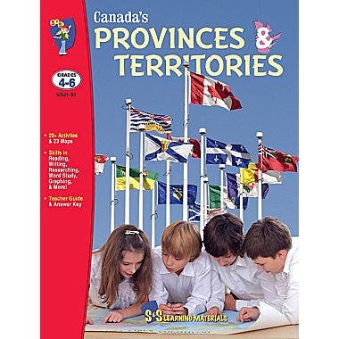
Students will study Canada's 10 provinces and three territories. During this study, students will develop and strengthen reading, research, and mapping skills.
Expand your student knowledge of Canada's:
- Physical Regions
- Climate
- Provinces
- Territories
- Capital Cities
- Bodies of Water
- Natural Resources
- Industrial Growth, and it's
- People
Includes 20+ activities, 23 maps, teacher guide, and answer key!
Seventeen lesson topics:
Lesson Plan #1: Where is Canada?
Lesson Plan #2: Canada’s Borders
Lesson Plan #3: Canada’s Provinces and Territories
Lesson Plan #4: Borders Inside Canada
Lesson Plan #5: Canada’s Capital Cities
Lesson Plan #6: Physical Regions of Canada
Lesson Plan #7: Rivers of Canada
Lesson Plan #8: Lakes of Canada
Lesson Plan #9: Canada’s Population
Lesson Plan #10: Climatic Regions of Canada
Lesson Plan #11: Canada’s Natural Vegetation
Lesson Plan #12: The Atlantic Provinces
Lesson Plan #13: Québec
Lesson Plan #14: Ontario
Lesson Plan #15: Manitoba, Saskatchewan, and Alberta
Lesson Plan #16: British Columbia
Lesson Plan #17: The Territories
Learning outcomes for students include:
- describe the physical features of regions within the provinces.
- identify how regions are interdependent in relation to their economies and governments.
- demonstrate and become aware of the various relationships, economically and culturally, etc., within and between Canadian regions.
- identify the characteristics of the physical regions of their individual province/territory and all of Canada.
- name and describe the main features of a river system.
- demonstrate an understanding of the significance of the St. Lawrence River and the Great Lakes System.
- identify Canada’s major natural resources and their uses.
- identify and describe types of communities in each physical region of each province and territory.
- demonstrate an understanding of the exchange of products within each province or territory and throughout Canada.
- identify the physical regions of Canada.
- describe and compare the physical environments of these regions according to landforms.
- identify the natural resources used to create Canadian products and the provinces/territories from which they originate.
- use appropriate vocabulary to describe their inquiries and observations.
- construct and read a variety of graphs, charts, diagrams, maps, and models for specific purposes such as to determine physical features, area of regions, size of populations, climate, etc.
- identify Ottawa as the capital city of Canada.
- locate and label the Great Lakes and other major bodies of water and waterways in Canada.
- identify symbols used to outline boundaries (international, national, provincial).
- locate and label the physical regions of Canada on a map.
- use cardinal and intermediate directions, non-pictorial symbols, and colour on a map to locate and describe physical regions.
Original: $25.69
-70%$25.69
$7.71Description
Students will study Canada's 10 provinces and three territories. During this study, students will develop and strengthen reading, research, and mapping skills.
Expand your student knowledge of Canada's:
- Physical Regions
- Climate
- Provinces
- Territories
- Capital Cities
- Bodies of Water
- Natural Resources
- Industrial Growth, and it's
- People
Includes 20+ activities, 23 maps, teacher guide, and answer key!
Seventeen lesson topics:
Lesson Plan #1: Where is Canada?
Lesson Plan #2: Canada’s Borders
Lesson Plan #3: Canada’s Provinces and Territories
Lesson Plan #4: Borders Inside Canada
Lesson Plan #5: Canada’s Capital Cities
Lesson Plan #6: Physical Regions of Canada
Lesson Plan #7: Rivers of Canada
Lesson Plan #8: Lakes of Canada
Lesson Plan #9: Canada’s Population
Lesson Plan #10: Climatic Regions of Canada
Lesson Plan #11: Canada’s Natural Vegetation
Lesson Plan #12: The Atlantic Provinces
Lesson Plan #13: Québec
Lesson Plan #14: Ontario
Lesson Plan #15: Manitoba, Saskatchewan, and Alberta
Lesson Plan #16: British Columbia
Lesson Plan #17: The Territories
Learning outcomes for students include:
- describe the physical features of regions within the provinces.
- identify how regions are interdependent in relation to their economies and governments.
- demonstrate and become aware of the various relationships, economically and culturally, etc., within and between Canadian regions.
- identify the characteristics of the physical regions of their individual province/territory and all of Canada.
- name and describe the main features of a river system.
- demonstrate an understanding of the significance of the St. Lawrence River and the Great Lakes System.
- identify Canada’s major natural resources and their uses.
- identify and describe types of communities in each physical region of each province and territory.
- demonstrate an understanding of the exchange of products within each province or territory and throughout Canada.
- identify the physical regions of Canada.
- describe and compare the physical environments of these regions according to landforms.
- identify the natural resources used to create Canadian products and the provinces/territories from which they originate.
- use appropriate vocabulary to describe their inquiries and observations.
- construct and read a variety of graphs, charts, diagrams, maps, and models for specific purposes such as to determine physical features, area of regions, size of populations, climate, etc.
- identify Ottawa as the capital city of Canada.
- locate and label the Great Lakes and other major bodies of water and waterways in Canada.
- identify symbols used to outline boundaries (international, national, provincial).
- locate and label the physical regions of Canada on a map.
- use cardinal and intermediate directions, non-pictorial symbols, and colour on a map to locate and describe physical regions.